Happy Sunday! Today showers and storms are expected to develop earlier. The moisture levels are high across the area and the west coast seabreeze will begin to fire up storms as early as 8 a.m Sunday morning. As we go through the rest of the morning into the afternoon expect numerous showers and storms across inland counties.
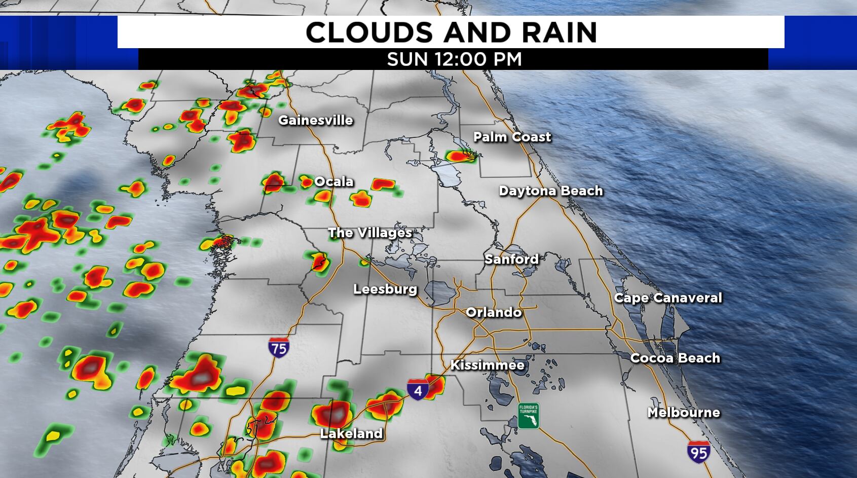
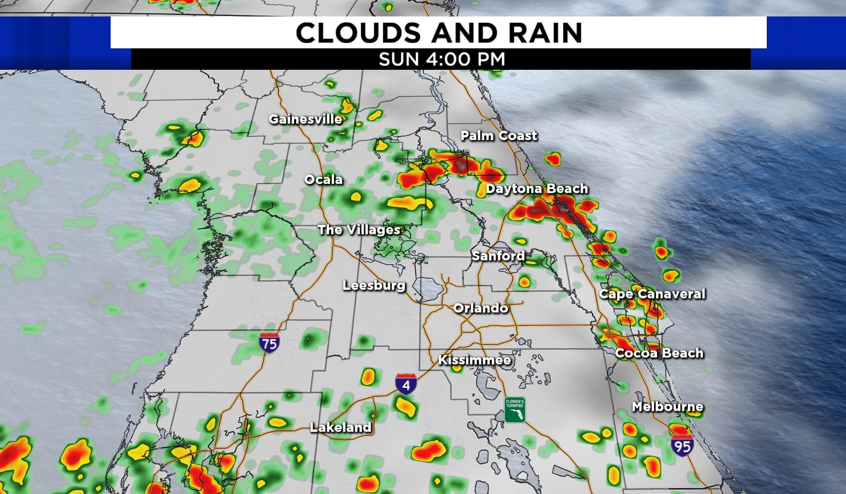
After 3 p.m showers and storms are expected to reach coastal areas producing heavy rain at times and strong gusty winds. Likely a few storms could become strong in a few cities producing wind gusts in excess of 50 mph, frequent lightning and a brief spin up or two are possible. There is a heat advisory for Brevard County today where heat index values could reach 110°. The scattered rain will help keep daytime highs in the lower 90s this afternoon across East Central Florida.
Monday expect showers and thunderstorms to develop during the morning hours and more showers and storms during the afternoon. Highs are expected to climb into the lower 90s under partly cloudy skies.
Through the rest of the week, a 50% coverage for showers and storms with highs staying near normal in the lower 90s daily.
Tropics update! We continue to watch 95L. Not a threat to any land but it is running into dry air and some wind shear as it moves west. The NHC has a medium chance of tropical development in the next few days. Don became a hurricane briefly on Saturday but it’s now moving over cooler waters and has weakened back into a tropical storm. It’ll continue to weaken as it travels over cooler water in the next few days.


 English (United States) ·